

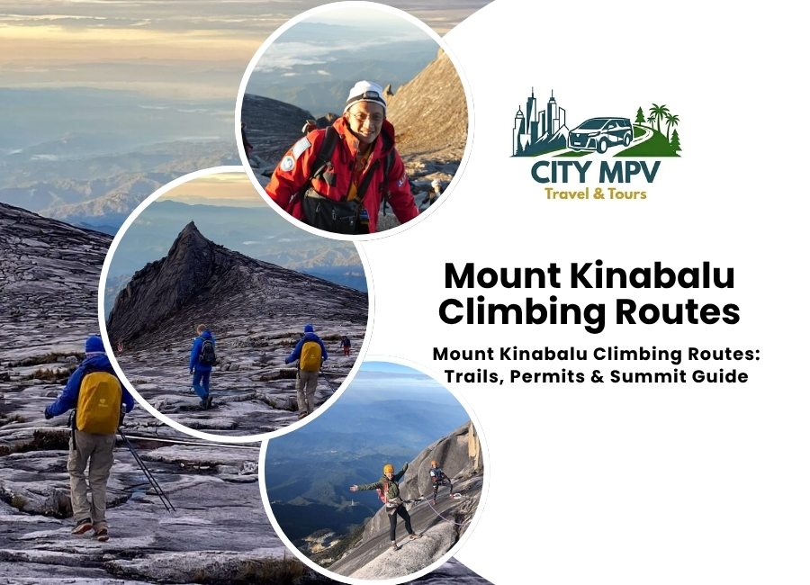
Mount Kinabalu stands at 4,095 metres, making it the highest peak in Borneo and one of the tallest mountains in Southeast Asia.
Every year, thousands of climbers register at Kinabalu Park to attempt the summit at Low’s Peak.
But before booking a climb, it helps to understand the actual route structure, since it has changed quite a bit over the years.
Stop scrolling and start traveling! City MPV Travel and Tours makes it easy to turn this into your next unforgettable trip. Seats fill fast, so grab yours today.
Book Your TourThere Is Only One Climbing Trail Now
A lot of older travel blogs still mention two routes, the Timpohon Trail and the Mesilau Trail. That information is outdated. I am covering complete route details and tips to climb Mount Kinabalu
The Mesilau Trail was damaged during the 2015 Sabah earthquake and has remained closed indefinitely since then.
Today, every climber ascends and descends through the Timpohon Trail, starting and ending at Timpohon Gate near Kinabalu Park Headquarters.
So when people search for climbing routes, what they are really choosing between are the two summit trail sections above the halfway point, not two separate mountain trails.
Stage One: Timpohon Gate to Laban Rata
The climb begins at Timpohon Gate, roughly 1,866 metres above sea level.
From here, climbers follow a well-maintained path through several vegetation zones.
You start in lowland rainforest with oak and chestnut trees, then move into mossy forest, and eventually reach alpine vegetation as the air gets thinner.
Along the way, there are rest shelters spaced roughly every kilometre.
These include Layang Layang, where the old Mesilau Trail used to join in, Villosa Shelter, Mempening Shelter, and Lowii Shelter.
This first stage usually takes between four and six hours, depending on fitness level and pace.
Most climbers arrive at Laban Rata, also called Panalaban Base Camp, sitting at about 3,272 metres.
This is where you rest, eat dinner, and sleep for a few hours before the final push.
Stage Two: The Summit Trails to Low’s Peak
After the 2015 earthquake, the final stretch to the summit was rebuilt and restructured for safety.
Climbers now leave Laban Rata around 2am and continue through Sayat-Sayat checkpoint, the last registration point before the summit.
From there, two named summit trail sections lead to Low’s Peak.
The Ranau Summit Trail was opened in December 2015, and the Kota Belud Summit Trail followed a year later in December 2016.
Both connect the same base route to the same destination, so most climbers simply follow whichever section is open on the day, based on trail conditions decided by park rangers.
This final stretch involves steep rock faces, fixed ropes, and exposed granite slopes.
It typically takes three to five hours to reach the top, timed so climbers arrive close to sunrise.
Weather can close the summit stretch without much notice.
Sabah Parks reports that this happens around fifteen to twenty times a year, so it is worth building a flexible schedule around your climb date rather than a tight one.
Via Ferrata: An Alternative for Non-Summit Climbers
For travelers who want the high altitude experience without committing to a full overnight summit attempt, Mount Kinabalu also offers a Via Ferrata route.
It starts at around 3,776 metres near Laban Rata and is often described as the highest via ferrata course in the world.
Climbers move along cabled routes bolted into the rock face, with harnesses and guides throughout.
It is a shorter, more accessible way to experience the mountain’s upper slopes, and it does not require reaching Low’s Peak itself.
Mount Kinabalu Permits, Guides, and Group Size
Climbing Mount Kinabalu is tightly regulated by Sabah Parks.
A mountain guide is compulsory for every climber, and this cannot be arranged independently on the day.
Climb permits are also limited, with only 163 issued per day, so booking well ahead of your travel dates matters more than people expect.
A valid passport or MyKad is required at registration, and most climbers book through a licensed operator that handles the permit application, guide assignment, and ID tag process as part of the package.
How Difficult Is the Climb
This is not a technical climb in the mountaineering sense, but it is physically demanding.
The distance itself is short, only around 8.7 kilometres from Timpohon Gate to the summit, but the altitude gain is steep and sustained.
Altitude-related fatigue, cold temperatures near the summit, and long stretches of stone steps are the main challenges rather than any single difficult section.
Reasonable fitness, proper layered clothing, and a slow, steady pace matter more than technical climbing experience.
Best Time to Climb Mount Kinabalu
The drier months between March and August generally offer clearer trail conditions and are considered the best time to climb Mount Kinabalu.
The wetter period from October to February can still work, but rain and cloud cover make summit views less predictable.
Either way, weather on Mount Kinabalu changes quickly at altitude, so climbers should pack for cold, wind, and rain regardless of season.
Stop scrolling and start traveling! City MPV Travel and Tours makes it easy to turn this into your next unforgettable trip. Seats fill fast, so grab yours today.
Book Your TourGetting to Kinabalu Park
Most climbers base themselves in Kota Kinabalu before heading up to Kinabalu Park Headquarters in Kundasang, since the drive takes around two hours depending on traffic.
If you are arranging your own transport rather than a fixed climb package, this is one part of the trip worth planning early, especially with early morning registration times and a return journey after a physically tiring two day climb.
City MPV Travel and Tours arranges private transfers around Kota Kinabalu and the highlands, which is a practical option for climbers who want a comfortable, timed pickup to Kinabalu Park without depending on shared transport or last-minute taxi availability.
You can check current transfer options through the tours page.